Path – wide viewPath – medium viewPath – close view
Time and Path:
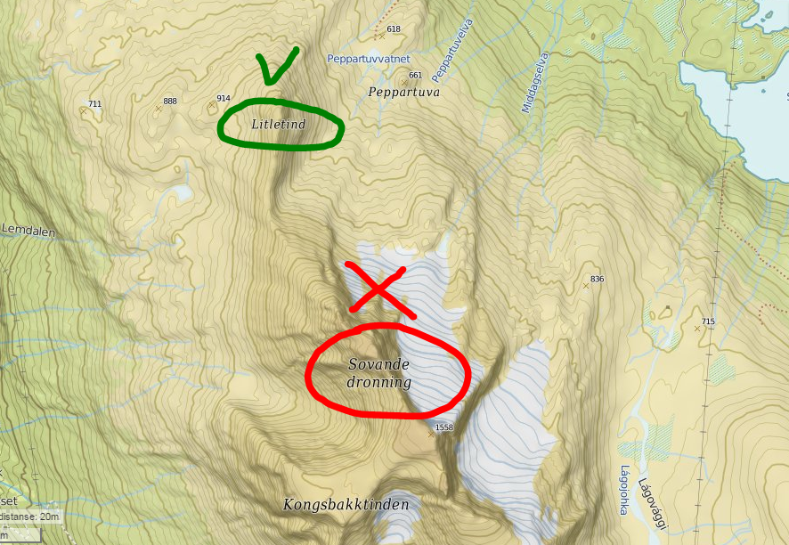
“The sleeping queen”, the highest mountain in Narvik region with its 1576 meters. The name came from its shape; looking at this mountain from Narvik you can definitely see the pofile of a women.
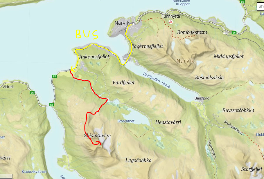
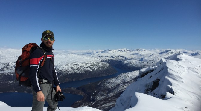
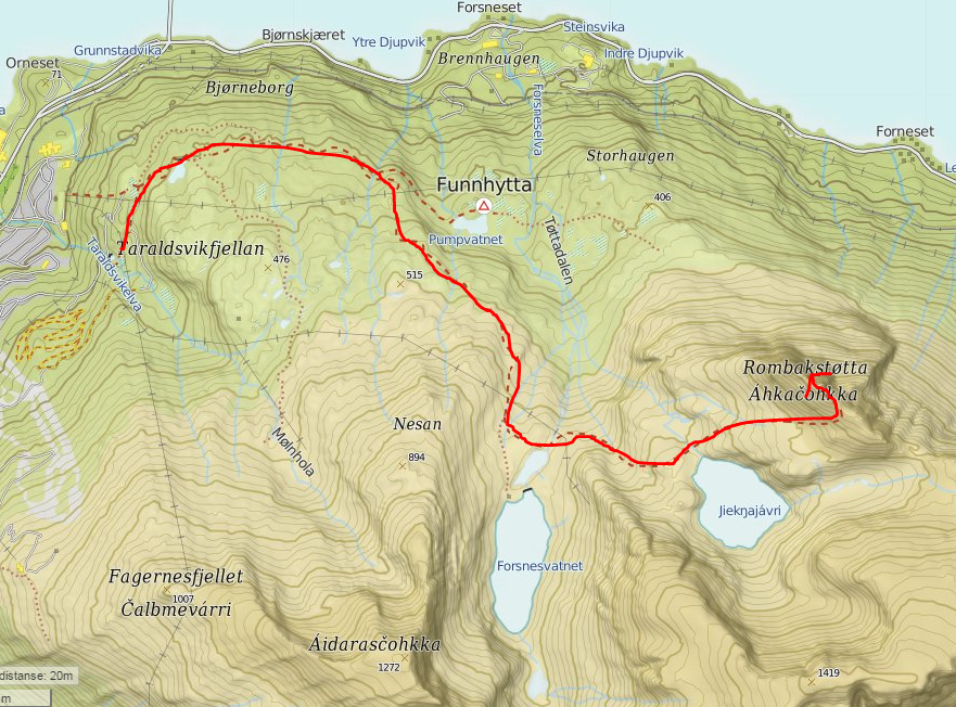
We left Narvik at 10:30 in the morning aiming to the top of Tottatoppen. This mountain is very famous here in Narvik at first because has a spectacular view over the city and second because there is a local myth that it lives a troll in this mountain. Anyway we needed to go there because the time available (before our departure) was getting shorter and shorter. Direction as always Funnhytta and then at the signal Pumpvann turn right. There was a lot of snow but with our snowshoes we managed quite well. Passed the 2 lakes we continued on the track till almost the top on a quite large path absolutely not dangerous. The last part on the crest was not so easy because it was really slippery. We removed snowshoes and continued on a narrow path rewally slowly till a point where we climbed up on the ice to get to the top! It would have been better just have a little ice ax to climb this part. The view from the top was incredible: mountains, Narvik city with the whole fiord around. After a quick break and the classical photo we came back on the same path. There was a lot of snow and walking with snowshoes was really tiring. We took 4 hours and a half go up and 2 hours and 45 to come back.
Pysical state: Trained
Notes: Very good to do with alpine ski! It is possible to ski almost to the top, and you can remove them for the last crest.
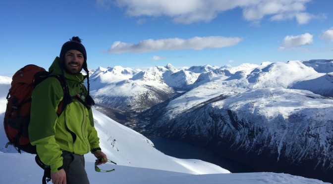
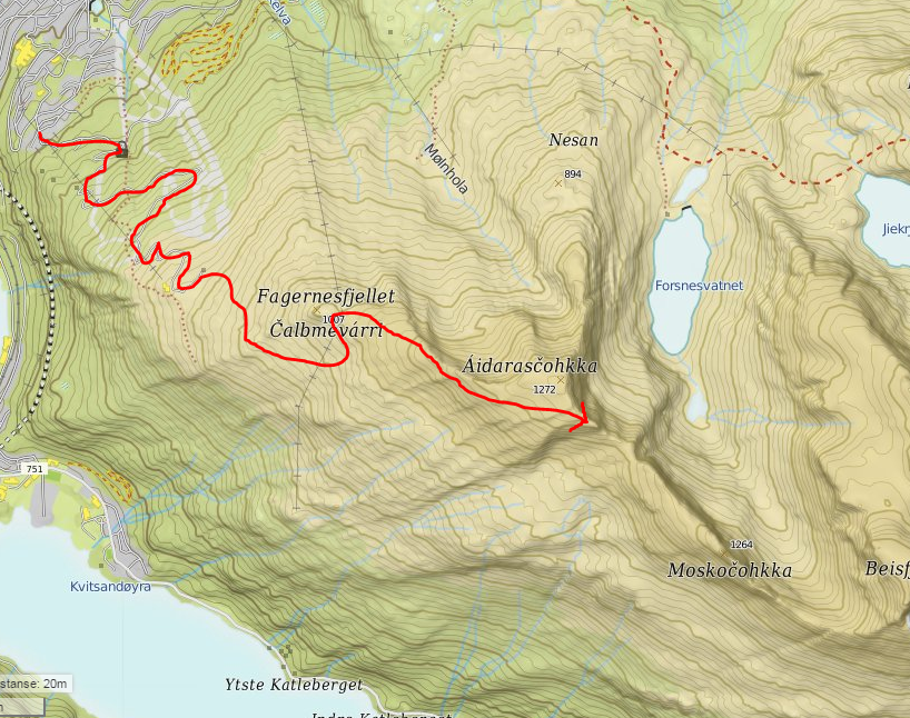
Superb get on Fagernestoppen (1008 meters) and then continue on to the crest to Tredjetoppen (1272 mt). From here you have a view of the mountains that separate Norway from Sweden, the fjord, and the highest mountain that’s in the area around Narvik. They call it “The sleeping queen”, (1575 meters) because the profile seen from Narvik resembles the face of a woman. Actually this is our next target. It is a quite short trip that one can do in an afternoon. From Narvik passing over the whole Narvikfjellet ski slopes you arrive at the antenna. Then you keep on going up beyond the antenna utill you arrive to the top of Tredjetoppen, the highest point reachable. From here you can see even Beisfjord. Wondeful view.
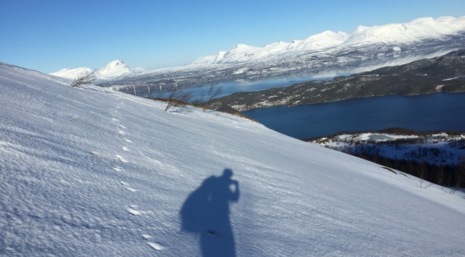
I left Narvik early in the morning. Target: the two lakes near Tottatoppen mountain. Direction: Funnhytta and then at the signal Pumpvann turn right. It was really difficult to find the right path because of the snow. Without map, or internet I just tryed to go towards the mountain passing across woods and steep slopes. After 2 hours I was in a wide open space full covered by snow but with sun on my face. Right ahead the first iced lake and the surprise: 3 reindeers!! After spending little time taking some photos and wishing a gun I moved towards the other lake. I was still thinking about that nice meeting when a herd of reindeers (at least 30-40) was staring at me with their horny heads straight at me. Wow, I had only the time to take a picture and then they run away. I just went up till the second lake, also this one iced and then I stopped for a quick lunch on a rock in sunny position. After that I just came back on the same path trying to see again the reindeers. It was impossible to go up to the top of Tottatopen because it was too slippery. I would have needed crampons or at least snowshoes.
Pysical state: Trained
Notes: Really panoramic path. Good place to see reindeers.
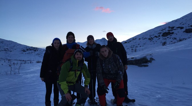
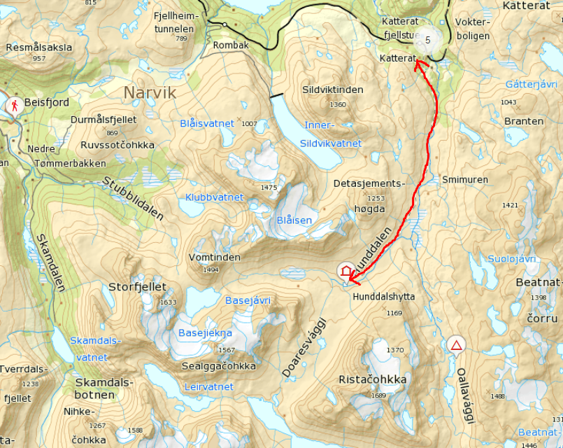
Time and Path: Easiest access is by train from Narvik, about half an hour, to the roadless station Katterat. From Katterat is about 12 km, 3-4 hour easy hike, mostly on construction roads. We left Katterat station at 2 pm walking towards Hunddalshytta, a small cabin with 14 beds in the middle of nowhere. The path is almost totally flat, with only some not really challenging uphill; because of this is better to go with snowshoes or crosscoutry skis. I went with Alpine skis but is not the best solution. After walking on this really visible path for 3 hours we reached our destination. We came back on the same path.
Physical state: Trained
Total difference in altitude: about 500-600 m
Notes:
Really freezing outside temperature: -16°C
"Qui sono io, qui è la mia casa, qui sono le mie montagne"